Why Intelifore?

Project Administration
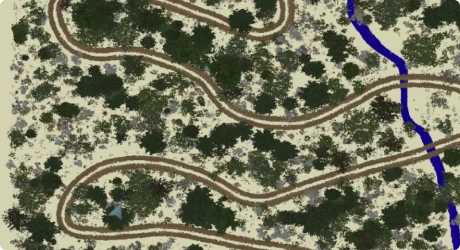
Optimize forest management project administration by leveraging GIS data, image segmentation, auto-formatting, team management tools, and legal templates.

Centralize Datasets
Automatically fetch the best public data to start your project with by simply defining the location and the project type. Combine these datasets with surveys your team has collected to increase accuracy and confirm your results.

Analysis
Use a cloud-based library of analysis tools, including utilities for R and Python. Run custom routines on any public dataset and link them together to create customized analysis pipelines to automate your workflow.

Consensus Building
Share information with all stakeholders, including members of the public. Communicate complex topics with interactive maps and display the future growth of the project with Visual Forester.

Workforce Management
Bring all parties to one table by enlisting help from consultants and Licensed Timber Operators. Schedule tasks and review documents to make sure you aren't held up later on.

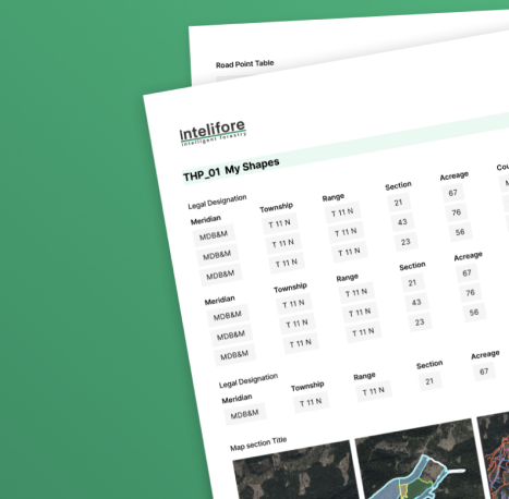
Project Exhibits
Automatically generate project exhibits that you can tailor to different audiences. These exhibits are living documents, so maps, graphs, photos, and other content are tied to interactive maps.
Use Cases
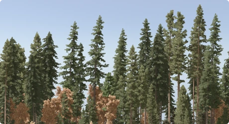
Forest Management Plans
Intelifore was built with timber harvest planning as its central goal. Management plans have a lot of moving parts and a lot of stakeholders. Our tools are built with cooperation and communication at their core and make it easy to work with any consultants no matter where they are.
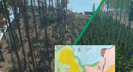
Communicate Your Commitment
Forest management is not done overnight. However, it can be hard to tell the story of a steward in just a few photos. Intelifore integrates real data with high-quality visualizations so you can show your strategy for 100 years; not just tomorrow.
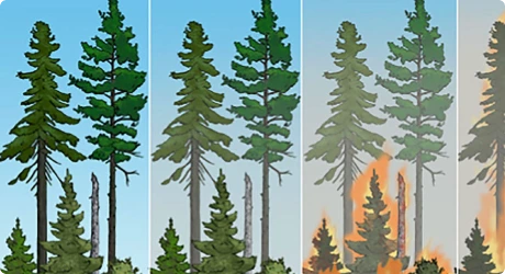
Wildfire Resilience
Preventing wildfires is a community effort. Intelifore makes it easy to make a project, survey the area, and find the right people to make your plan a reality.
Carbon Project Areas
Identify land suitable for carbon projects of every type. Leverage our feasibility analysis tools and perform landcover segmentation to find areas of high productivity. Source project analysts and the data they need to create the projects.
Use Cases
Forest Management Plans
Intelifore was built with timber harvest planning as its central goal. Management plans have a lot of moving parts and a lot of stakeholders. Our tools are built with cooperation and communication at their core and make it easy to work with any consultants no matter where they are.
Communicate Your Commitment
Forest management is not done overnight. However, it can be hard to tell the story of a steward in just a few photos. Intelifore integrates real data with high-quality visualizations so you can show your strategy for 100 years; not just tomorrow.
Wildfire Resilience
Preventing wildfires is a community effort. Intelifore makes it easy to make a project, survey the area, and find the right people to make your plan a reality.
Carbon Project Areas
Identify land suitable for carbon projects of every type. Leverage our feasibility analysis tools and perform landcover segmentation to find areas of high productivity. Source project analysts and the data they need to create the projects.
Sign Up to Be an Early User
Get release date information and the latest development news.