How It Works
Create a Project
Landowners register land they would like to enroll in a forest management project and create a proposal that is forwarded to employees registered on Intelifore.

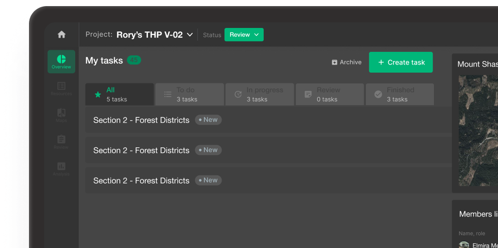
Add Tasks to Your Project
The project manager will now source help internally and assign tasks to staff members best suited for the project.
Upload Resources
The project manager will now compile all the freely available data from our resource library and supplement it with their proprietary data.
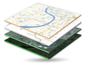
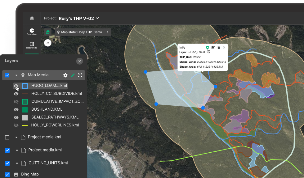
Edit Maps View
Maps will then be created and saved with different focus points and layer settings. These versions of the maps will be saved as "states" and applied within the document to answer specific questions.
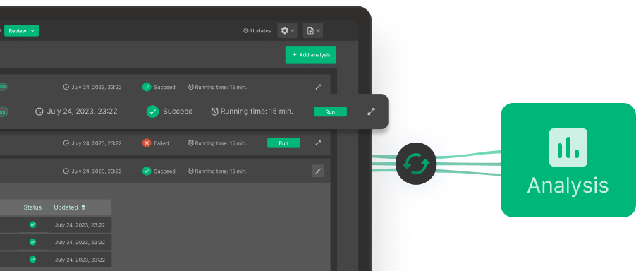
Perform Analysis
After maps are prepared, analysts can begin leveraging Intelifore`s analysis tools to answer project questions.
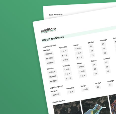
Visualize Project Outcomes
All forms filled out through the templates are automatically formatted for presentation to the public. These exhibits use maps, analytics, photos, and local expertise to educate the public about long-term forest management and help show how much care and diligence it takes to formulate a harvest plan.
More Solutions
More Solutions | Visual Forester
When planning forest futures, the decisions we make today have a far-reaching impact. Driven by your real-world data and powered by our photorealistic 3D techniques, Visual Forester creates immersive forest visualizations that help communicate crucial information and facilitate better decision-making.
How It Work
Create a Project
Landowners register land they would like to enroll in a forest management project and create a proposal that is forwarded to employees registered on Intelifore.
Add Tasks to Your Project
The project manager will now source help internally and assign tasks to staff members best suited for the project.
Upload Resources
The project manager will now compile all the freely available data from our resource library and supplement it with their proprietary data.
Edit Maps View
Maps will then be created and saved with different focus points and layer settings. These versions of the maps will be saved as "states" and applied within the document to answer specific questions.
Perform Analysis
After maps are prepared, analysts can begin leveraging Intelifore`s analysis tools to answer project questions.
Visualize Project Outcomes
All forms filled out through the templates are automatically formatted for presentation to the public. These exhibits use maps, analytics, photos, and local expertise to educate the public about long-term forest management and help show how much care and diligence it takes to formulate a harvest plan.
More Solutions
Visual Forester
When planning forest futures, the decisions we make today have a far-reaching impact. Driven by your real-world data and powered by our photorealistic 3D techniques, Visual Forester creates immersive forest visualizations that help communicate crucial information and facilitate better decision-making.
Sign Up to Be an Early User
Get release date information and the latest development news.